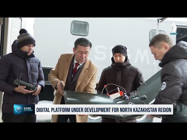
The North Kazakhstan region’s digital
platform is being developed. Using the DeepBas artificial intelligence system,
it will integrate data from space, air, and water resources. All the collected information will
enable science-based decision-making. Thirteen teams, comprising a total of 75
scientists, are working on the project.
«The data sources are diverse. They may include statistical data, remote sensing images, and
various cartographic information. In addition, materials from stations located
in the region, as well as the results of field studies, are used. We interpret
satellite remote sensing images and use them to create
medium-accuracy maps,» noted earth remote sensing and cartography group
leader Asset Arystanov.
To study the region’s environment and collect data, scientists use drones as well as the multifunctional mobile SIGMA complex. They enable scientists to analyze the collected information using AI and to forecast potential emergencies. The project has been underway since 2024.
«Last
year, we conducted a survey of the Yessil
River. As you know, there was a major flood several years ago. We created a
digital map of the coastal terrain, which allows us to monitor changes in water
levels,» said UAV systems expert Timur Tamenov.
Related Articles